

알턴 호텔 검색: 지금 예약 가능한 인기 숙소
 계획이 변경되어도 안심무료 취소가 가능한 호텔 예약
 마음에 딱 맞는 옵션약 100만 개의 전 세계 숙박 시설 검색 가능
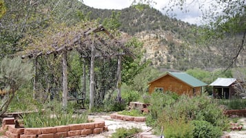
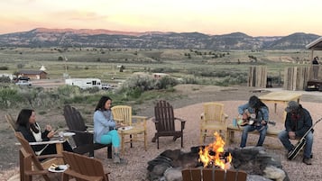
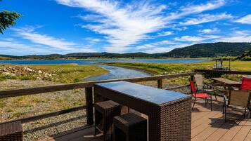
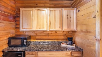
알턴의 이색적인 숙소를 찾아보세요!
반려동물 동반 가능
아파트
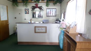
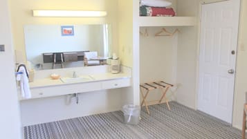
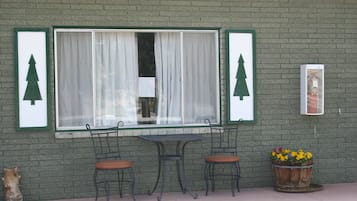
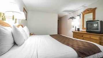
인기 많은 알턴 호텔


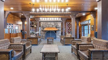
1. 히스토릭 스미스 호텔 B&B
히스토릭 스미스 호텔 B&BGlendale
10점 만점 중 9.2점, 매우 훌륭해요, (이용 후기 529개)
“좋은 서비스에 편안함, 맛있은 점심. 가격대비 아주 좋은 선택. 오래되긴 했지만 좋은 경험 이였다.”

JiYun
현재 요금 ₩157,824
총 요금: ₩179,788
세금 및 수수료 포함
8월 4일 ~ 8월 5일


2. 89 & 나인 모텔
89 & 나인 모텔Orderville
10점 만점 중 8.6점, 훌륭해요, (이용 후기 214개)
현재 요금 ₩137,248
총 요금: ₩157,723
세금 및 수수료 포함
8월 4일 ~ 8월 5일


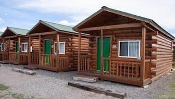
3. 마운틴 리지 캐빈 앤드 로징
마운틴 리지 캐빈 앤드 로징Hatch
10점 만점 중 9.2점, 매우 훌륭해요, (이용 후기 1,001개)
현재 요금 ₩154,153
총 요금: ₩177,306
세금 및 수수료 포함
8월 4일 ~ 8월 5일


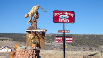
4. 브라이스 게이트웨이인 캐빈
브라이스 게이트웨이인 캐빈Panguitch
10점 만점 중 7.8점, 좋아요, (이용 후기 889개)
“통나무집이라 그런지 소음이 있었습니다. 더군다나 길거리에 있어 자동차 소리가 심했구요.”
Eunsub
현재 요금 ₩93,543
총 요금: ₩105,629
세금 및 수수료 포함
8월 3일 ~ 8월 4일

5. 해치 스테이션 모텔과 레스토랑
해치 스테이션 모텔과 레스토��랑Hatch
10점 만점 중 8.6점, 훌륭해요, (이용 후기 448개)
“Half price compared to other hotels.
Small but managed clean.”
익명의 여행객
현재 요금 ₩70,528
총 요금: ₩81,136
세금 및 수수료 포함
8월 3일 ~ 8월 4일


6. 베스트 웨스턴 이스트 자이언 썬더버드 로지
베스트 웨스턴 이스트 자이언 썬더버드 로지Orderville
10점 만점 중 9.2점, 매우 훌륭해요, (이용 후기 1,001개)
“방은 나쁘지않습니다.
다만,주변에 편의 시설이 거의 없어서 좀 불편하고,가격도 좀 비싼 �것같습니다.
직원이 데스크를 비워서 첵인이 오래 걸렸습니다.”
KYUNGAE
현재 요금 ₩150,051
총 요금: ₩172,438
세금 및 수수료 포함
8월 31일 ~ 9월 1일

7. 브라이스 자이온 인
브라이스 자이온 인Hatch
10점 만점 중 7.8점, 좋아요, (이용 후기 560개)
“늦은시간에 체크인을 하였는데 친절히도 기달려주시고 난방 준비까지 해주어서 고마웠음
시설은 호텔이라기보단 모텔정도 그러나 그 지역특성상
이��해는 합니다”
JINSOO
현재 요금 ₩84,921
총 요금: ₩96,839
세금 및 수수료 포함
8월 3일 ~ 8월 4일


8. 브라이스 캐년 파인스
브라이스 캐년 파인스Bryce Canyon
10점 만점 중 8.0점, 매우 좋아요, (이용 후기 1,017개)
현재 요금 ₩89,383
총 요금: ₩100,931
세금 및 수수료 포함
8월 23일 ~ 8월 24일


9. 로드웨이 인 브라이스 캐년
로드웨이 인 브라이스 캐년Panguitch
10점 만점 중 8.0점, 매우 좋아요, (이용 후기 1,001개)
현재 요금 ₩75,191
총 요금: ₩84,907
세금 및 수수료 포함
8월 23일 ~ 8월 24일


10. 더 리버사이드 랜치 RV 파크, 모텔 & 캠프그라운드
더 리버사이드 랜치 RV 파크, 모텔 & 캠프그라운드Hatch
10점 만점 중 9.2점, 매우 훌륭해요, (이용 후기 596개)
현재 요금 ₩152,939
총 요금: ₩172,699
세금 및 수수료 포함
8월 31일 ~ 9월 1일


11. 애로우헤드 컨트리 캐빈스
애로우헤드 컨트리 캐빈스Mount Carmel
10점 만점 중 9.6점, 최고예요, (이용 후기 91개)
“I found this property very charming. While we had to leave to early to get the included breakfast, we were very impressed with all the amenities and the property. Now, one thing that may throw people off is that the property owners are very hands off and only show up during breakfast hours. I personally like it as they treat you as an adult, and in return you have pretty much free rain around the property as long as you don’t bother the animals. You will have to travel for food, but they...

Brian
현재 요금 ₩207,826
총 요금: ₩296,389
세금 및 수수료 포함
8월 3일 ~ 8월 4일

12. 브라이스 캐니언의 더 로지
브라이스 캐니언의 더 로지Bryce Canyon
10점 만점 중 8.8점, 훌륭해요, (이용 후기 132개)
“Great location right by the rim, patio was beautiful”
Kevin
현재 요금 ₩263,039
총 요금: ₩297,024
세금 및 수수료 포함
8월 15일 ~ 8월 16일


13. 덕 크리크 빌리지 인
덕 크리크 빌리지 인Duck Creek Village
10점 만점 중 9.4점, 최고예요, (이용 후기 175개)
현재 요금 ₩278,944
총 요금: ₩327,579
세금 및 수수료 포함
8월 11일 ~ 8월 12일


14. Galaxy of Hatch between Bryce and Zion
Galaxy of Hatch between Bryce and ZionHatch
10점 만점 중 8.4점, 매우 좋아요, (이용 후기 32개)
“Yeah, it was totally awesome. Unique. Well done for an older establishment. The ambience made our motorcycle trip complete.”
Andrew
현재 요금 ₩115,291
총 요금: ₩131,440
세금 및 수수료 포함
8월 3일 ~ 8월 4일
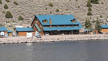

15. 애스펜 코브 리조트
애스펜 코브 리조트Panguitch
10점 만점 중 7.0점, 좋아요, (이용 후기 68개)
“Great place to stay. Family owned. Fair priced. Incredible location for lake views, fishing and boat rentals. Will return and highly recommend.
”
Antonio
현재 요금 ₩268,077
총 요금: ₩302,712
세금 및 수수료 포함
8월 3일 ~ 8월 4일


16. 더 로지 앳 덕 크리크
더 로지 앳 덕 크리크메도우 뷰 하이츠
10점 만점 중 9.4점, 최고예요, (이용 후기 98개)
현재 요금 ₩309,602
총 요금: ₩569,029
세금 및 수수료 포함
8월 9일 ~ 8월 10일


19. 레드 캐니언 빌리지
레드 캐니언 빌리지Panguitch
10점 만점 중 4.8점, (이용 후기 3개)
“So bad we checked out early! Our "Premier" cabin was less than premier. Poor linens, it was maybe 12' from the highway, the television did not work nor any internet connection. We talked to the person who checked us in, and he moved us to a much smaller cabin where everything was supposed to work. We tried to make it work but just couldn't. The bed was smaller and uncomfortable and when we tried to take a shower in a very inadequate space the water smelled severely of sulfur. It made us sick....
Kimberly
현재 요금 ₩214,462
총 요금: ₩242,171
세금 및 수수료 포함
8월 3일 ~ 8월 4일


20. 브라이스 업탑 로지
브라이스 업탑 로지Bryce Canyon
10점 만점 중 7.0점, 좋아요, (이용 후기 985개)
“직원의 친절한 응대는 최고였다. 시설은 대체적으로 양호했다”
sangcheol
현재 요금 ₩116,587
총 요금: ₩131,650
세금 및 수수료 포함
8월 7일 ~ 8월 8일
표시된 요금은 지난 24시간 이내 성인 2명 1박 기준 최저가입니다. 요금과 예약 가능 여부는 변경될 수 있으며, 추가 약관이 적용될 수 있습니다.

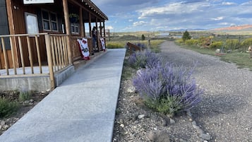
알턴 인기 명소 근처 숙소
알턴에 대해 자세히 알아보기
알턴에 가시면 하이킹, 야생동식물, 어드벤처 등을 직접 경험하고 즐겨보세요!

Eric & Kristy's Adventures 님의 사진
Eric & Kristy's Adventures 님의 공개 사진

저렴한 알턴 숙소

로드웨이 인 브라이스 캐년
3090 UT 12 Panguitch UT
8월 23일부터 8월 24일까지 요금은 1박당 ₩75,191입니다.
₩75,191
총 요금: ₩84,907
8월 23일 ~ 8월 24일
세금 및 수수료 포함
8/10 매우 좋음! (이용 후기 1,001개)


자주 묻는 질문(FAQ)
익스피디아와 떠나는 세계 여행
- 선라이즈 포인트 근처 호텔
- 유타 남서부 – 브라이스캐니언의 간이 주방이 있는 호텔
- 브라이스캐니언의 포우사다
- 브라이스캐니언의 캐빈
- 브라이스캐니언의 스파가 있는 리조트 및 호텔
- 브라이스캐니언의 하우스보트
- 유타 남서부 – 브라이스캐니언의 카지노 호텔
- 선셋 포인트 근처 호텔
- 브라이스캐니언의 호스텔
- 나바호/퀸즈 가든 루프 근처 호텔
- 유타 남서부 – 브라이스캐니언의 모텔
- 시더 브레이크스 국가기념지의 개인 별장
- 트로픽 호텔
- 브라이스캐니언의 주차 가능 호텔
- 브라이스캐니언의 웨딩 호텔
- 앤젤스 랜딩 근처 호텔
- 브라이언 헤드 스키 리조트 근처 호텔
- 스왐프 캐년 근처 호텔
- 브라이스캐니언 근처 호텔
- 유타 남서부 – 브라이스캐니언의 캐러밴 파크
- 레인보우 포인트 근처 호텔
- 브라이스 내추럴 브리지 근처 호텔
- 유타 남서부 – 브라이스캐니언의 목장
- 브라이스캐니언 호텔
- 해치 호텔
- 유타 남서부 – 브라이스캐니언의 코티지
- 유타 남서부 – 브라이스캐니언의 Motel 6 호텔
- 코다크롬 분지 국립공원 근처 호텔
- 더크 크릭 빌리지 호텔
- 유타 남서부 – 브라이스캐니언의 캐빈
- 브라이스캐니언의 반려동물 동반 가능 호텔
- 더 내로우스 근처 호텔
- 마운트카르멜 호텔
- 벙커 크리크 트레일헤드 근처 호텔
- 유타 남서부 – 브라이스캐니언의 2성급 호텔
- 브라이스캐니언의 저렴한 호텔
- 유타 남서부 – 브라이스캐니언의 온수 욕조가 있는 호텔
- 브라이스캐니언의 온수 욕조가 있는 호텔
- 판귀치 호텔
- 브라이언 헤드 호텔
- 캐니언 포인트 호텔
- 커내브 호텔
- 오더빌 호텔
- 브라이스캐니언의 가족 여행 호텔
- 글렌데일 호텔
- 시온 자연 공원 동문 입구 근처 호텔
- 브라이스 캐니언 국립공원 근처 호텔
- 브라이스 포인트 근처 호텔
- 브라이스캐니언의 모텔
- 리버�사이드 산책로 근처 호텔
- 브라이스캐니언의 로맨틱 호텔
- 딕시 국유림 근처 호텔
- 매머드 동굴 근처 호텔
- 브라이스캐니언의 게스트하우스

