
차링
여행 가이드


차링 여행 정보
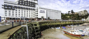
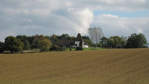
그랜드 벌스틴 호텔 포크스톤
The Harbour Folkestone England
7월 26일부터 7월 27일까지 요금은 1박당 ₩87,047입니다.
₩87,047
총 요금: ₩104,464
7월 26일 ~ 7월 27일
세금 및 수수료 포함
포크스턴에 있는 이 호텔에 숙박해 보세요! 무료 WiFi, 2 개 레스토랑, 아침 식사(요금 별도) 등의 편의 시설/서비스를 이용하실 수 있죠. 특히 아침 식사, 친절한 고객 서비스 등이 고객들로부터 좋은 반응을 얻고 있습니다. 주변에 포크스턴 비치, 도버 크루즈 터미널 서쪽 부두 ...
7/10 좋음! (이용 후기 1,016개)
"None. Very basic."
후기 작성 날짜: 2026년 7월 10일

하이드 임피리얼 호텔 스파 & 골프
Princes Parade Hythe England
7월 19일부터 7월 20일까지 요금은 1박당 ₩209,849입니다.
₩209,849
총 요금: ₩251,819
7월 19일 ~ 7월 20일
세금 및 수수료 포함
하이드의 해변 호텔입니다. 무료 WiFi, 무료 주차, 해변 등의 편의 시설/서비스를 이용하실 수 있죠. 특히 아침 식사, 수영장 등이 고객들로부터 좋은 반응을 얻고 있습니다. 주변에 포트 림프네 야생 동물 공원, 머큐어 하이스 임페리얼 스파 네이처엘 같은 인기 명소가 있어 관광을 ...
9/10 매우 훌륭함! (이용 후기 1,142개)
"Had an amazing stay this time, room was amazing and staff friendly and helpful. Think drink prices are very expensive"
후기 작성 날짜: 2026년 7월 11일

오리다 메이드스톤 호텔
Bearsted Rd Maidstone England
8월 9일부터 8월 10일까지 요금은 1박당 ₩120,686입니다.
₩120,686
총 요금: ₩144,824
8월 9일 ~ 8월 10일
세금 및 수수료 포함
메이드스톤에 있는 이 호텔에 숙박해 보세요! 무료 WiFi, 아침 식사(요금 별도), 피트니스 센터 등의 편의 시설/서비스를 이용하실 수 있죠. 특히 아침 식사, 수영장 등이 고객들로부터 좋은 반응을 얻고 있습니다. 주변에 리즈 성, 빈터스 밸리 자연 보호 구역 같은 인기 명소가 ...
8.6/10 훌륭함! (이용 후기 1,363개)
"너무좋음 추천함"
후기 작성 날짜: 2025년 11월 22일
표시된 요금은 지난 24시간 이내 성인 2명 1박 기준 최저가입니다. 요금과 예약 가능 여부는 변경될 수 있으며, 추가 약관이 적용될 수 있습니다.

파인우드 캠핑 포즈 - 포트 림프네 리저브에서
Port Lympne Reserve Hythe England
하이드에 있는 이 캠핑장에 숙박해 보세요! 무료 WiFi, 무료 주차, 2 개 레스토랑 등의 편의 시설/서비스를 이용하실 수 있죠. 주변에 포트 림프네 야생 동물 공원, 림픈 포트 야생동물 공원 & 정원 같은 인기 명소가 있어 관광을 즐기기에도 좋아요.
9.6/10 최고 좋음! (이용 후기 37개)
"Beautiful setting and in the evening you heard the lions roar"
후기 작성 날짜: 2026년 6월 22일

아스펜도스 호텔
Mill Rd Sturry England
캔터베리에 있는 이 아파트식 호텔에 숙박해 보세요! 로비의 벽난로, 바/라운지, 커피숍/카페 등의 편의 시설/서비스를 이용하실 수 있죠. 주변에 캔터베리 대성당, 윗스테이블 항구 같은 인기 명소가 있어 관광을 즐기기에도 좋아요.
2/10 (이용 후기 3개)
"It was god awful."
후기 작성 날짜: 2026년 6월 27일

호그와트 베드 앤드 컨티넨탈 브렉퍼스트
Bell Farm Lane Sheerness England
쉬어니스에 있는 이 코티지에 숙박해 보세요! 무료 주차, 매일 하우스키핑, 피크닉 공간 등의 편의 시설/서비스를 이용하실 수 있죠. 주변에 민스터 게이트하우스 박물관, 바튼스 포인트 국가 공원 같은 인기 명소가 있어 관광을 즐기기에도 좋아요.
9.4/10 최고 좋음! (이용 후기 122개)
"Lovely holiday retreat in the countryside,secure location,clean comfy rooms and friendly staff.A fabulous self service continental breakfast to enjoy."
후기 작성 날짜: 2026년 7월 8일
표시된 요금은 지난 24시간 이내 성인 2명 1박 기준 최저가입니다. 요금과 예약 가능 여부는 변경될 수 있으며, 추가 약관이 적용될 수 있습니다.
차링 인기 명소 근처 숙소
차링 근처 도시


익스피디아와 떠나는 세계 여행
- 보턴 언더 블린 호텔
- 셰피 섬의 호스텔
- 하티 호텔
- 캔터베리의 B&B
- 블린 호텔
- 페탐의 3성급 호텔
- 에거튼 호텔
- 셰피 섬의 4성급 호텔
- 쉬어니스의 4성급 호텔
- 플럭클리의 모텔
- 페탐의 개인 별장
- 스테이플허스트 호텔
- 헤드콘 호텔
- 쉬어니스 호텔
- 채플 다운 와이너리 근처 호텔
- 셰피 섬의 컨트리하우스
- 애시퍼드 호텔
- 셰피 섬의 농장체험 숙박 시설
- 애쉬포드 디자이너 아울렛 근처 호텔
- 캔터베리의 게스트하우스
- 셰피 섬의 5성급 호텔
- 켄트 호텔
- 셰피 섬의 B&B
- 시팅본 호텔
- 셰피 섬의 타운하우스
- 애시퍼드의 4성급 호텔
- 차트 서튼 호텔
- 더딩턴 호텔
- 보튼 골프 클럽 근처 호텔
- 오아 건파우더 워크스 카운티 파크 근처 호텔
- 셰피 섬의 하우스보트
- 보턴 언더 블린 호텔
- 뱁차일드 호텔
- 캔터베리의 아파트
- 페탐 호텔
- 캔터베리의 금연 호텔
- 셰피 섬의 리조트
- 메이드스톤의 게스트하우스
- 비던든 와이너리 근처 호텔
- 킹스노스 호텔
- 크란브룩 골프 클럽 근처 호텔
- 플럭클리 호텔
- 성 밀드레드 교회 근처 호텔
- 쉬어니스의 개인 별장
- 셰피 섬 여행
- 켄트 여행
- 플럭클리 여행
- 시싱허스트 성 & 정원
- 채플 다운 와이너리
- 스웨일 주 여행
- 켄트 여행
- 메이드스톤 박물관
- 데인 존 정원
- 시싱허스트 여행
- 브레드허스트 여행
- 스텔링 미니스 여행
- 페탐 여행
- 시팅본 & 켐슬리 경편 철도
- 린스테드 여행
- 하스필드 여행
- 비던든 와이너리
- 웨스트게이트 가든스
- 크랜브룩 여행
- 어퍼 하블다운 여행
- 세인트 던스턴 교회
- 워든 여행
- 다게이트 여행
- 윗스터블 여행
- 림 여행
- 엠리 여행
- 그래프티 그린 여행
- 하이드 여행
- 플럭클리 여행
- 캔터베리 여행
- 애플도어 여행
- 엘햄 여행
- 리즈 성
- 배넨든 여행
- 메이드스톤 여행
- 애쉬포드 디자이너 아울렛
- 켄트 대학교
- 와이 여행
- 포스트링 여행
- 성 밀드레드 교회
- 세인트 마이클스 여행
- 시팅본 여행
- 포트 림프네 야생 동물 공원
- 캔터베리 여행
- 스텔링 여행
- 하티 여행

